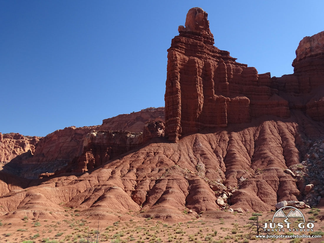
There are a ton of great Capitol Reef National Park hikes that are worth trying out when visiting this remote location in Utah. While much of the park can be very challenging (and time consuming!) to get to, there are great rewards in both the Fruita District (which is where visitors tend to spend most of their time) and the other more remote parts of Capitol Reef National Park.
For those that do want to hike, it can be daunting trying to go through the dozens of hikes in Capitol Reef National Park and narrow it down to just one or two if you are limited on time. That’s why we wanted to put together this list of great hikes in Capitol Reef National Park to help take the guesswork out of planning your upcoming trip.
CAPITOL REEF NATIONAL PARK HIKING: DISTANCES AND ELEVATION GAIN
We get asked this question a lot. To help out, we’ve put together a few graphs to help you know what might be best for you. Of course, a lot depends on what you want to see, but it also depends on how far you want to hike and how much you want to climb.
Here are the easiest hikes if you just want a fairly quick stroll.

In the chart below, we show the moderate hikes-these are good for people that are up for a little challenge and can also handle some distance.

If you are up for something difficult, you can use this chart to help out with deciding which of the most strenuous hikes to take on.


Our Capitol Reef National Park Itinerary helps speed up your planning by helping you discover where to spend your precious time when visiting Capitol Reef National Park. From the best hikes in Capitol Reef (in ranked order) to what to pack, where to stay and what else to do in the area, our itinerary can help with all of it!
BEST HIKES IN CAPITOL REEF NATIONAL PARK: TRAIL DESCRIPTIONS AND TRAIL MAPS
HICKMAN BRIDGE TRAIL

Hickman Bridge Trail map, courtesy of the National Park Service
Without a doubt, the Hickman Bridge Trail is the most popular day hike in Capitol Reef National Park. And for good reason-the hike to Hickman Bridge is relatively easy (even in the heat of the day) and ends with a terrific surprise. The Hickman Bridge Trail is moderately difficult hike (mainly because of the exposure to the sun) with a 1.8-mile round-trip distance and climbs 406 feet in elevation.
The trail starts by splitting between a rock wall and the Freemont River. After separating from the river, the trail heads up in elevation. As the trail climbs, there are great views of Navajo Dome and Pectol’s Pyramid-two large rock monoliths that dominate the horizon.
The trail ends at Hickman Bridge, which is a 125-foot natural bridge that stands 130 feet above the ground. At the bridge there is plenty of space to relax and there is even a little bit of shade, which can be a welcome break before returning back to the parking lot.
The trailhead starts 1.8 miles east of the visitor center on Highway 24.
Hike Option: The Hickman Bridge Trail share a trailhead with the Navajo Knobs trail. If you take the Navajo Knobs Trail at the split (0.2 miles into the hike), the trail is a challenging 9.1-mile round trip with over 2000 feet in elevation gain. This trail offers fantastic views, but be prepared as it is quite the journey, especially in the heat!

CASSIDY ARCH TRAIL

Cassidy Arch Trail map, courtesy of the National Park Service
Similar to the Hickman Bridge Trail, the Cassidy Arch Trail offers a very doable hike for families with a nice payoff at the end. Though slightly longer, this 3.3-mile hike (round trip) has a moderately-easy difficulty and climbs 607 feet in total elevation gain.
After starting on level ground on the Grand Wash Trail, the Cassidy Arch Trail splits off to the west. After an initial rise (which is quite steep), the trail slowly gains in elevation as it heads steadily up toward Cassidy Arch.
This amazing arch is quite the sight and offers a great view. Some visitors say that this hike is the highlight of their visit to Capitol Reef National Park.
The trailhead starts at the end of Grand Wash Road. Take the Scenic Drive 3.4 miles south. Grand Wash Road is on the left. Continue to the end of the road for parking.
Hike Option: Combine the Cassidy Arch Trail with the Grand Wash Trail (which extends to Highway 24).

Cassidy Arch Trail photo provided by Jimmy Thomas
GRAND WASH TRAIL

Grand Wash Trail map, courtesy of the National Park Service
The Grand Wash Trail is a relatively flat trail that heads through a canyon wash. Along the way you’ll see towering walls. Seeing as those these walls provide shade, you can see both plant and animal life.
The hike is 4.5-miles (round trip) and you’ll find yourself in the shade most of the time. The total amount of climbing that you can expect is about 440 feet, though the hike never gets to be that steep in any part.
The trail can be reached at two different trailheads: the easiest place to get to the trail is from Highway 24, about 4.5 miles east of the visitor center. The other option is to go to the end of Grand Wash Road, which is a dirt road about 8 miles south of the visitor center.

Grand Wash Trail photo provided by Ken Lund
NAVAJO KNOBS TRAIL

Navajo Knobs Trail map, courtesy of the National Park Service
The Navajo Knobs Trail is a challenging 9.1-mile round-trip trail. What makes it challenging is the distance, the elevation gain and also the amount of exposure. In fact, if you hike this in the summer, you better be prepared for plenty of heat and sun, no matter what time of day you start your hike.
The trail starts on the Hickman Bridge trail for the first 0.2 miles, then splits to the right to head to the Rim Overlook Trail. After the overlook (which is at about the 2.1-mile point) the trail turns into the Navajo Knobs Trail.
The trail is exposed for the entire time and climbs constantly. There is a total elevation gain of just under 2100 feet.
At the end of this out-and-back hike is an amazing panoramic view, afforded to you if you climb up the Knobs (after a short scramble). Even if you don’t do this, you will have great views along the entire route.
The trailhead starts 1.8 miles east of the visitor center on Highway 24 (at the same location as the Hickman Bridge trail).

Navajo Knobs Trail photo provided by Rick McCharles
CAPITOL GORGE TRAIL

Capitol Gorge Trail map, courtesy of the National Park Service
The Capitol Gorge Trail is a 2.1-mile round-trip hike with moderately easy difficulty. With an elevation gain of only 83 feet and with entertainment along the length of the trail, this hike is terrific for families.
After starting out on the hike, this relatively flat trail follows a dry creek bed through a gorge. The gorge isn’t wide-only 10 feet at some points! After about a quarter-mile in, you’ll find petroglyphs which will keep young hikers entertained. There is also a Pioneer Register about 0.5 miles into the hike.
This hike provides a nice alternative to hiking out in the open, as it can be in the shade more so than any other trail, depending on the location of the sun and the time of day.
The trailhead starts at the end of Capitol Gorge Road, which is a dirt road about 8 miles south of the visitor center.
Hike Option: After about 0.7 miles, take a left. This slight detour leads to “The Tanks”, which are large potholes in a rock.

Capitol Gorge Trail photo provided by Ian Keating
CHIMNEY ROCK TRAIL

Chimney Rock Trail map, courtesy of the National Park Service
The Chimney Rock Trail is a 3.5-mile round-trip hike with moderate difficulty. Climbing nearly 800 feet in elevation, this hike offers panoramic views of the Waterpocket Fold. This is one of the shorter trails with such great views.
What’s nice about this hike in particular is the fact that it is a loop, allowing hikers to stay interested during the entirety of the hike.
This trek is particularly good in the early part of the day or around sunset, as the colors can be just amazing.
Tip: Hike counterclockwise to get through the steepest part of the trail first.
The trailhead is located in the Fruita District, 3.1 miles west of the visitor center on Highway 24.

FREMONT RIVER TRAIL

Fremont River Trail map, courtesy of the National Park Service
This trail is really split up into two parts. Starting off very easy and flat, the trail heads along the river for the first 0.7-miles, before arriving at a viewpoint. This is a beautiful part of the hike that we’d highly recommend for families.
Towards the end of this 2.1-mile (round-trip) hike, the trail climbs up to a great panoramic viewpoint. The climb lasts for the last 0.4-miles of the trail, and adds up to about 400 feet total elevation gain throughout the hike.
This hike is highly recommended for anyone up for a small climb and great views!
The trailhead starts 1.1 miles south of the visitor center and just south of the Gifford House.

Fremont River Trail photo provided by Scott Teresi
CATHEDRALS TRAIL
The Cathedrals Trail is in the Cathedral District, which is the Northern Waterpocket Fold. This moderately-difficult trail climbs its 313 feet in elevation as it traverses though grasslands. After heading alongside a mesa, the views open up to the Cathedrals, which are a set of parallel monoliths.
Once you arrive at the top of the hill, there are fantastic panoramic views.
The trailhead starts 2.4 miles north of the junction of Hartnet Road and Cathedral Road. Both of these roads are dirt roads.
COTTONWOOD WASH TRAIL
The Cottonwood Wash Trail is in the central portion of the Waterpocket Fold. This moderately-challenging, 6.1-mile (round-trip) trail climbs 1207 feet in total elevation. After hiking for about 1.2 miles, the trail enters the Carmel Formation. It is at this point that the trail starts to climb steadily through the canyon.
This trail requires plenty of rock scrambling and can be quite challenging at points, but is totally worth it.
The trailhead starts 9.1 miles south of Highway 24 on the Norton-Bullfrog Road. This part of Capitol Reef is very isolated, so be sure to bring plenty of water and supplies.
GOLDEN THRONE TRAIL

Golden Throne Trail map, courtesy of the National Park Service
The Golden Throne Trail is a moderately-challenging, out-and-back hike. Climbing just over 800 feet, this 3.6-mile (round-trip) trek climbs steadily uphill, leading up to views of the Golden Throne. The views along the way are nice, though be advised that there are other trails that offer better views throughout the hike. However, this trail is still worth the time if you have it!
The trail starts at the end of Capitol Gorge Road at the same spot as the Grand Wash Trail.

Golden Throne Trail photo provided by Qfl247
SURPRISE CANYON TRAIL
The surprise canyon trail is a moderately difficult trail that travels 2.2 miles (round-trip) with about 423 feet in elevation gain. After crossing a grassy area, the trail heads into a deep, narrow canyon. It ends at the base of a water runoff.
This trail is marked with cairns (small rockpiles), which makes navigation on this trail quite easy.
The trailhead is located 34 miles south of Highway 24 on the Norton-Bullfrog Road, just 1.5 miles south of the junction with the Burr Trail Road.
FURTHER INFORMATION ON CAPITOL REEF NATIONAL PARK FROM JUST GO TRAVEL STUDIOS
- We cover information all these trails and more in our itinerary for Capitol Reef National Park.
- One of our favorite parts of Capitol Reef was the hike to the Hickman Bridge Trail-make sure you read our article on this fantastic hike! You can also get tips on what to bring on your trip in our blog, What to Pack for Capitol Reef National Park. If you camping in the park, then we recommend our blog on Camping in Capitol Reef National Park.
- After your trip, send us a photo so we can create custom, vintage-style posters, postcards and note cards that are personalized and made just for you!

ADDITIONAL USEFUL INFORMATION ON CAPITOL REEF NATIONAL PARK
- Harmony and Stephanie (from “The Salt Project”) wrote up a great article on the Cassidy Arch Trail. Check it out if you are looking for further information!
- If you’d like a good overview of one of our favorite hikes, check out the blog from Theresa on Hiking the Hickman Bridge Trail.

